Tag Archives: James River and Kanawha Canal

The James River and Kanawha Canal

25 Aug

The James River and Kanawha Canal was to have been the key to Virginia becoming the economic center of the emerging United States in the late 1700’s. The project was envisioned by George Washington who surveyed and planned for the canal. In 1785, the James River Company was formed. A name change would create the James River and Kanawha Canal Company.

1865_James_River_and_Kanawha_canal

The purpose of the canal was to create a way to ship goods and people inland from Richmond. The hope was to connect the James River with the Kanawha River (in present day West Virginia) that would then connect to the Ohio River, the Mississippi River and finally to the Gulf of Mexico.

The problems began almost immediately. Floods and a shortage of funds hindered progress considerably. By 1790, a seven mile stretch from Richmond to Westham had opened. The War of 1812 caused it to slow as did the construction through the Piedmont’s rocky terrain. In 1820, the Commonwealth of Virginia took over the project and by 1825 the canal had reached Maidens Adventure in Goochland.  By 1851, the canal reached its furthest point, Buchanan, 196.5 miles west of Richmond.

lockkeepers

The Lock-keepers House at Cedar Point

The canal met further delays during the Civil War when goods and people were not moving. Following the Civil War, the final blow to the canal came with the completion of railroad service to the Ohio River. In 1878, the James River and Kanawha Canal Company gave up and sold its towpaths to the Richmond and Allegheny Railroad Company. Turning basins, towpaths, and lock-keepers houses began to disappear with the rise of the locomotive.

Genito Culvert

Genito culvert

Beginning in the late 20th century there was a renewed interest in the old canal. In 1971, a 138 acre James River and Kanawha Canal Historic District was created. Richmond has a Canal Walk that stretches for 1.25 miles and Scottsville has a wonderful Canal exhibit. Goochland has the last remaining Lock-keepers house which was built in 1836 to serve Lock Number 7 at Cedar Point. There are also still a few culverts and aqueducts hidden in the woods along the old towpath which itself can still be seen in several places alongside of River Road West. Possibly one day Goochland itself will have a Canal Park to commemorate the part it once played in Washington’s great vision.

Goochland – A Historical Sketch

28 Feb

DSCN1382

In the fall of this year, the Goochland County Historical Society will be publishing the 45th volume of our magazine. In commemoration of this, we will be posting a few articles on the blog from the back issues. Our first post will be the first article printed in Volume 1, No. 1, a short history of the county by Helene Barret Agee, the first Society historian.

HISTORICAL SKETCH

Goochland County, named for Sir William Gooch, Lieutenant Governor of Virginia from 1727 to 1749, was formed in 1728 from Henrico, an original shire of the Virginia Colony. The original boundaries of Goochland were from Tuckahoe Creek, on both sides of the James River, west as far as the English King’s Dominion extended. From Virginia were formed the states of Ohio, Kentucky and parts of Tennessee. The present boundaries of Goochland are: Tuckahoe Creek on the east, the James River on the south, Fluvanna County on the west and portions of Louisa and Hanover Counties on the north. The county’s land area consists of 289 square miles. The highest elevation is 520 feet, taken at Shannon Hill, the lowest elevation 110 feet, taken at the point where Tuckahoe Creek joins the James River.

Goochland’s present courthouse is believed to be its third. It was “received” as completed on August 20, 1827, by the Commissioners for the County. The county has had several jails. The last was built of stone and is still standing. The brick wall around the present Courthouse Square was built in 1840.

By virtue of inheritance, Goochland claims Manakintowne, on the south side of the James River where the Huguenots settled in 1700. By the same token the county fell heir to the three original Monacan Indian Village sites namely, Mowhemencho, Massinacak and Rassawek.

Thomas Jefferson was born at Shadwell in Goochland County on April 13, 1743. When Albemarle was formed from Goochland on October 16, 1744, Shadwell then fell within the borders of the new county and Albemarle inherited this historic site. Thomas Jefferson spent his early childhood at Tuckahoe, also in Goochland, where he was tutored by the Reverend William Douglas and others.

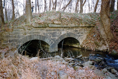
George Washington was the first President of the James River Company which later became the James River and Kanawha Company. The James River and Kanawha Canal, on the south border of Goochland, played an important role in the economic and social life of the county. In the year 1808 the canal was considered one of the most successful internal improvements in the country.

Thomas Mann Randolph, born at Tuckahoe, and James Pleasants, born at Contention, served as Governors of Virginia.
James A. Seddon of Sabot Hill was elected to the First Confederate Congress and later became Secretary of War, Confederate States of America.

Goochland furnished a son for the cabinet of each of the opposing governments during the War Between the States, Edward Bates of Belmont in the cabinet of Lincoln, and James A. Seddon in the Confederate cabinet of Jefferson Davis.

Other members of the Bates family in Goochland also became prominent: Frederick Bates was governor of Missouri from 1824 to 1826; James Bates a member of Congress from Arkansas, and Thomas Fleming Bates a member of the Virginia Convention of 1829.

General Nathaniel Massie (born 1763-died 1813) served with the Goochland Militia. Later moving to Kentucky where his father, Nathaniel Massie, Sr., had been granted lands, he established, in 1791, a village which later became Manchester, one of the four earliest settlements in what is now Ohio. He laid off the town of Chillicothe, and became the first Major General of the 2nd Division, Ohio Militia, when Ohio was admitted as a State, serving until 1810. He held many high offices, including the presidency of the Senate.

During the Revolutionary War Lord Cornwallis and is troops invaded Goochland. They encamped at Thomas Jefferson’s estate, Elk-hill, for ten days and destroyed all barns with contents and appropriated all cattle, sheep and hogs for the sustenance of their army, and all horses capable of service. Colonel Tarleton raided Rock Castle (Queen Anne Cottage) and tore from the walls the Tarleton coat-of-arms and carried it away. Upon retiring from the County, Lord Cornwallis admired an imposing view overlooking the James River and declared that if he should ever reside in America this would be his choice for a home site. This location has since been known as Cornwallis’ Point.

On his way to Monticello to visit Thomas Jefferson in 1824, General Lafayette visited Goochland and spent the night at the Courthouse.

During the War Between the States, Colonel Ulric Dahlgren and his troops paid a visit to Goochland, leaving souvenirs at many places, especially Sabot Hill, Dover and Eastwood. Goochland recalls with pride eighteen-year-old James Pleasants who single-handed, “killed one Federal and captured thirteen.”

Those who are interested in Genealogy will be glad to know that Goochland’s official records were not destroyed during “the War”, and that eight counties were formed from Goochland soil since its separation from Henrico on 1, May 1728. These counties are: Albemarle (1744), Cumberland (1749), Amherst (1761), Buckingham (1761), Powhatan (1777), Fluvanna (1777), Nelson (1808), Appomattox (1845). Their early records are available in the Goochland County Clerk’s Office.

The Lock-Keepers House at Cedar Point

16 Nov

The Lock-Keeper’s House, circa 1836, is the last remaining lock-keeper’s house from the James River and Kanawha Canal system.  Located on Cedar Point Road in Goochland, the little building is a reminder of a time when the river was the fastest way to reach Richmond and the world.

lock

Personally surveyed and planned by George Washington, The James River and Kanawha Canal began in 1785 to ease shipments of passengers and goods from the interior of Virginia to the coast.  After a series of financial difficulties, the Commonwealth of Virginia took over and in March of 1832, the James River and Kanawha Canal Company was formed to extend the canal to the Ohio River.  By 1836 a lock was needed to move the traffic around the rocks at Cedar Point so Lock Number 7 was constructed.  The Lock-Keeper’s house was built alongside the lock for toll collection, invoice and cargo checking and as a tavern for the passengers of canal boats.  The house was in use for these purposes until the late 1800’s when the Richmond and Allegheny Railroad laid tracks on the old towpath of the canal.  Railroads led to an end of the canal era but the house stayed in use as a home for the railroad section masters.  The house was finally sold into the private sector in the 1960’s.

house

The Cedar Point Lock-Keeper’s house is a two-story frame structure on a stone foundation.  The foundation is whitewashed 18” granite and the upper stories are covered in weatherboard.  The interior is still arranged, as it would have been in the canal era, three stacked rooms to the right and three to the left.  There are two stairways, one at either end of the house.  One was for the lock-keeper and the other was for guests of the tavern.  The top floor is divided into two rooms for overnight accommodations and do not connect.  The easternmost room was for ladies.  The two top rooms were reached by different staircases which allowed the ladies to come and go without having to go through the tavern.

house2

The building has been damaged by floods and hurricanes on several occasions.  Two lines to the left of the basement entrance commemorate two early floods, one marked “30 Sept. 1870” and the other is for 1877.  Hurricane Camille arrived in 1969 with more flooding but the highest level so far would be caused by Hurricane Agnes.  That event in June of 1972 caused the river to rise 15 feet above flood stage causing water to rise 3 feet above the second level floor.  A bronze plaque commemorates Hurricane Agnes’ flood level on the outside of the house.  In November of 1974, the Lock-Keeper’s House was named to the National Register of Historic Places.

plaque

The Lock-Keeper’s House is currently listed for sale with Goochland Realty, Inc. realtor Vernell Burton.  The house has been converted to a home and offers a cozy atmosphere and incredible views of the James River.  The Historical Society is hoping that a buyer will keep the home intact for future generations.  If you are interested in purchasing the house, call 804-784-5288.

James River

James River

Contributed by James Richmond of the Goochland County Historical Society

To read more about The Lock-Keeper’s House: read volume 7, No. 1 of the Goochland County Historical Society’s magazine.

The James River and Kanawha Canal Exhibit

9 May
The James River & Kanawha Canal Exhibit

The James River & Kanawha Canal Exhibit

For the past month, the Historical Society has been quite busy restoring dioramas that represent the James River and Kanawha Canal through Goochland.  We had a model of Tuckahoe plantation built, and we restored a model of an aqueduct, coal and wood boats, Lock 9 in front of the Lockkeeper’s house, and a furnished representation of the Lockkeeper’s house.  Joe Higgins, the husband of Kay Higgins, a volunteer at the Historical Society, and Laura Meadows, the Historical Society’s Intern worked on the project during the entire month of April.

Laura Meadows works on restoring the bridge

Laura Meadows works on restoring the bridge

With the help of Andy Donnelly and Scott Johnson, both volunteers at the Historical Society, all boxes and dioramas were successfully moved into the 22 ft. x 3 ft. display space located in J. Sargeant Reynolds’ new Community Room.  The new exhibition was officially opened at an event hosted by J. Sargeant Reynolds’ Community College on April 26, 2013.

Joe Higgins and Andy Donnelly prepare to move the boxes into the display space for the first time.

Joe Higgins and Andy Donnelly prepare to move the boxes into the display space for the first time.

Over 100 people attended the “Garden Party” in the 2,145 sq. ft. Community Room that will house the Society’s exhibit.  A large table of assorted cheeses and finger foods kept the crowd entertained before J. Sargeant Reynolds’ Community College President Gary Rhodes welcomed everyone and introduced Society President Wayne Dementi and Executive Director Phyllis Silber.  All who spoke reminded the crowd of the team effort involved with bringing this Community Room and exhibit to fruition.

Intern Laura Meadows, Nam Rhodes, wife of J. Sargeant Reynolds' President Gary Rhodes, and Society Board member Ginny Olsen

Intern Laura Meadows, Nam Rhodes, wife of J. Sargeant Reynolds’ President Gary Rhodes, and Society Board member Ginny Olsen

Afterwards, the attendees were invited to take guided tours of the campus and gardens.  The event brought attention to the college that is part of Goochland’s fabric.  The James River and Kanawha Canal exhibit is not permanent but will be on display for the next few months.  Goochlanders should take the chance to stop by the campus to see the exhibit and tour the gardens.

The photo wall, part of the collaboration between the Society and J. Sargeant Reynolds

The photo wall, part of the collaboration between the Society and J. Sargeant Reynolds